Lünersee-Rätikon hut route "Medium"


Tour description
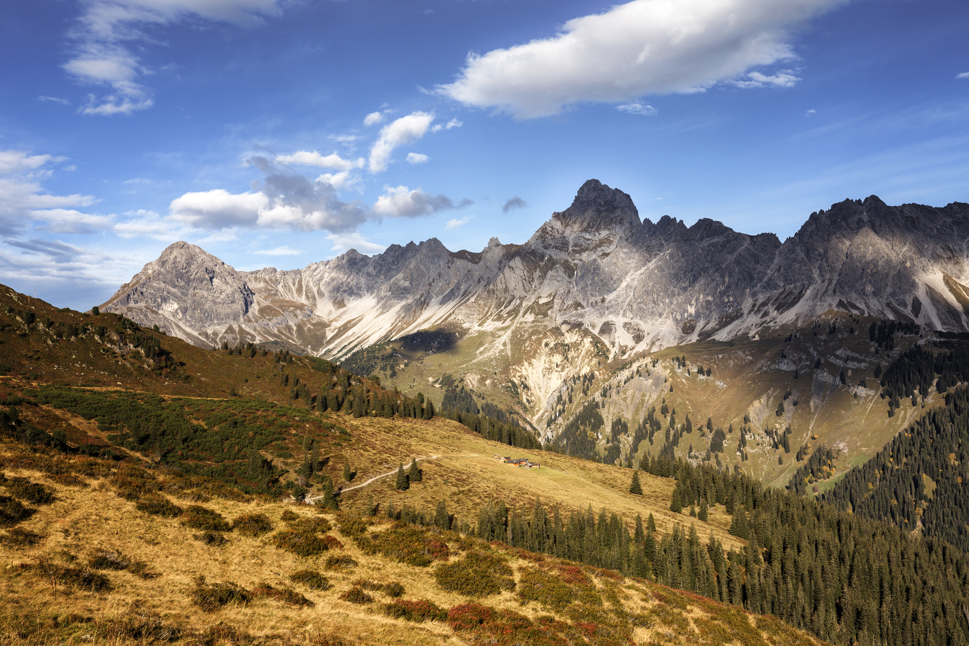
This panoramic Montafon hut hike through the diverse Rätikon takes you past the steep limestone mountains of the Rätikon.
Approach
Coming from Bludenz on the B188, you need to turn off at the intersection on the main road before Schruns towards Tschagguns and drive on to Latschau.
Public transport
Just leave your car standing
The Montafonerbahn’s regional buses run throughout the Montafon area. The main lines run hourly from Schruns station.
From Schruns station you can take bus line 601 to the Golmerbahn in Latschau. The stop is: "Golmerbahn".
For the return journey
Bus line 601 takes you from Latschau back to Schruns station.
Travel by train
From Bludenz station the Montafonerbahn runs hourly (partly every half hour). There are also direct connections from Lindau (D) and from Bregenz.
Directions
Stage 1: Golmerbahn mountain station to Heinrich Hueter Hut
(same route as stage 1 of the Lünersee/Rätikon "Easy" hut route)
Starting from the Golmerbahn mountain station, follow the signpost towards Platzisalpe, continue through the shaded forest and past the Rellstal mountain inn until after another ascent you arrive at the Heinrich Hueter Hut.
Walking time approx. 3:15 hrs // approx. 7.8 km // ascent 385 m, descent 520 m
Stage 2: Heinrich Hueter Hut to Totalp Hut
Through the Lünerkrinne and past the Lünersee, it goes to the foot of the Schesaplana, the highest mountain in the Rätikon. The Totalp Hut is located here.
Walking time approx. 3:50 hrs // approx. 7.6 km // ascent 855 m, descent 241 m
Stage 3: Totalp Hut to Lindauer Hut
From the Totalp Hut, it goes above the Lünersee and past the Lünersee-Alpe further to Vera Joch. From here you already have the first view of the impressive Swiss Gate before it goes over the Öfapass to the Lindauer Hut.
Walking time approx. 4:45 hrs // approx. 10.6 km // ascent 501 m, descent 1,139 m
Stage 4: Lindauer Hut to Latschau
(same route as stage 4 of the Lünersee/Rätikon "Easy" hut route)
From the Lindauer Hut, walk with the Drei Türme behind you past the lower Sporaalpe as well as the Gauertalhaus, which is ideal for a short break before you arrive back at the car.
Walking time approx. 2:15 hrs // approx. 6.2 km // ascent 0 m, descent 752 m
Equipment
Good, ankle-high hiking boots with good grip, sufficient provisions and drinks to take along, hiking poles recommended
Tips
Due to high demand in the huts, you should plan your route in advance and book overnight stays in the huts early.
Destination
Latschau
Starting Point
Golmerbahn mountain station
Sicherheitstipps für Wandern in Vorarlberg
EN NOTRUF:
EN 140 - Alpine Notfälle österreichweit
EN 144 - Alpine Notfälle Vorarlberg
EN 112 - Euro-Notruf (funktioniert mit jedem Handy/Netz)


 Roland Fritsch, Montafon Tourismus")
 Dietmar Denger / Vorarlberg Tourismus")


